Mimer MapView
Mimer MapView will present your GPS equipped radios on a map or satellite photo.
You can keep track of your mobiles and portables, and you will be alerted if anyone pushes the emergency button on the radio.

Using Mimer MapView
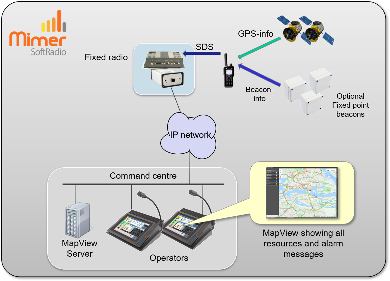
Mimer MapView is an option to Mimer SoftRadio that presents your radio units on a map utilising Google Maps, Open Street Maps or your own ofline maps.
Each radio unit will be presented with an operator selected icon on the map. The operator can easily centre and zoom the map on one unit. He can also fetch more information about the unit, with a simple click.
Fixed points can be marked on the map, for example the location of your office or an important customer.
A fixed radio is used for collection of the positions. This radio is connected to the SoftRadio system through a Network Interface.
Showing your units
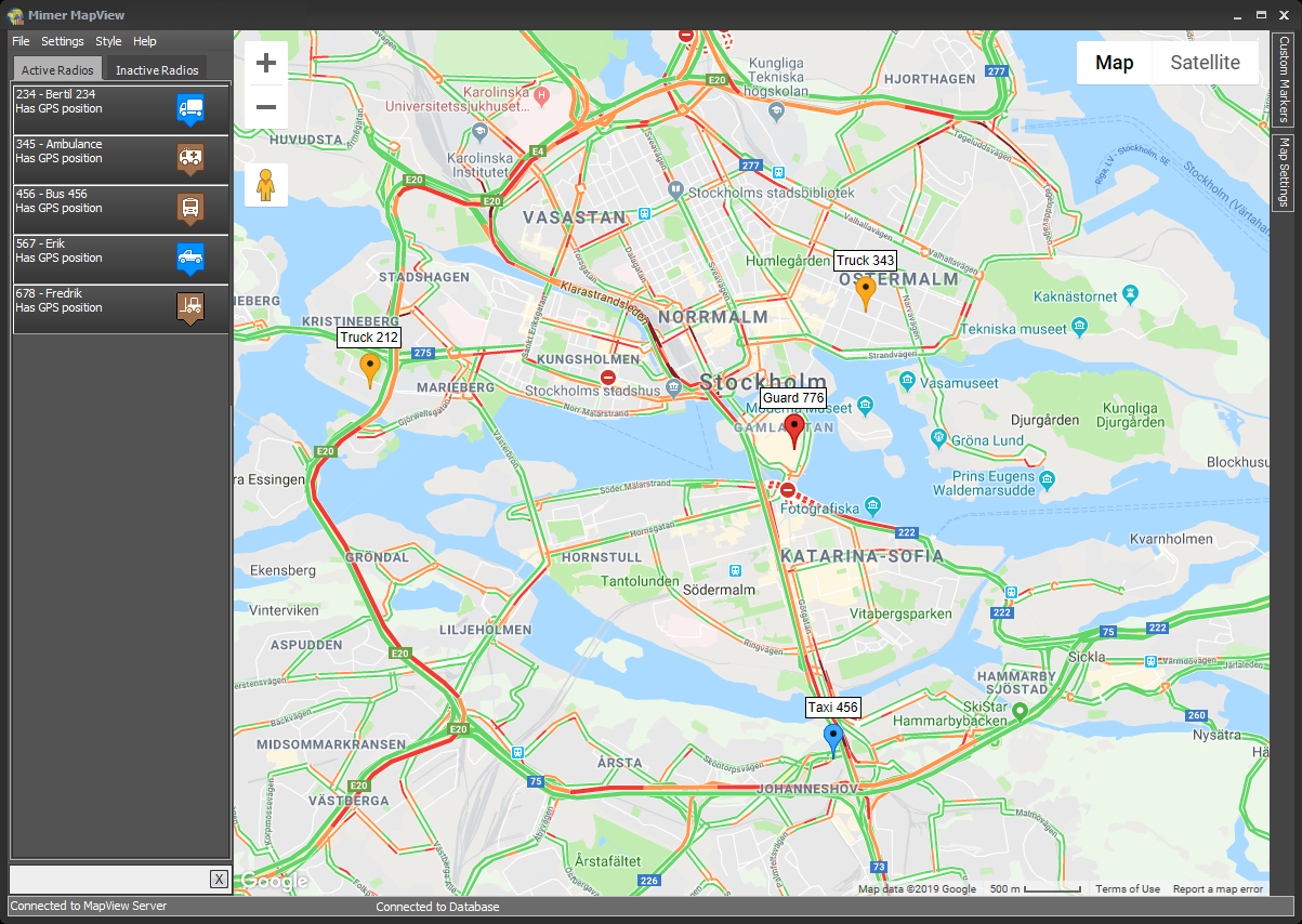
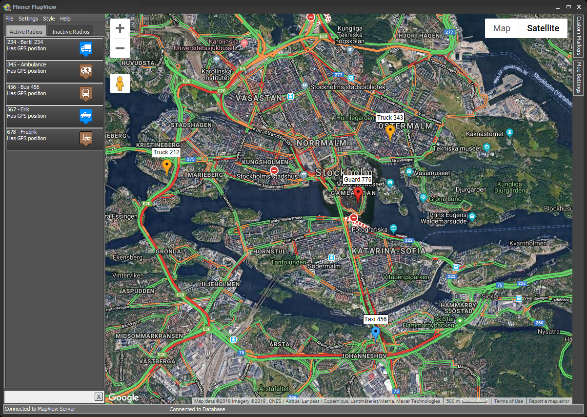
The main window is the map view showing icons of active radios and custom markers.
At the left is a list showing all the active radios. Using the tabs at the top you can select to show active radios or inactive radios. At the bottom left is an edit box used to search on Radio ID:s or Radio Names in the displayed list.
Finding your radios
Clicking on a radio in the list to the left will move the map so that radios position is centred on the map. You can also right click and select “Zoom in and centre on map” from the popup menu.
Track and Trace
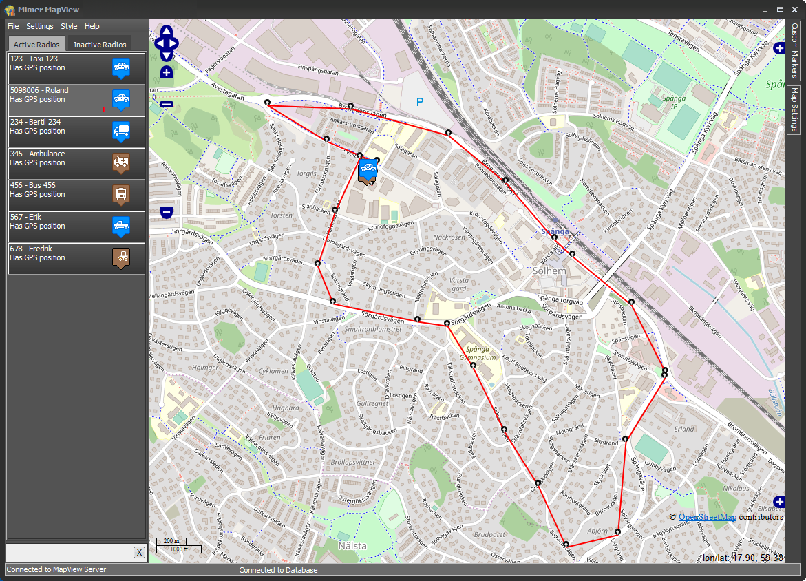
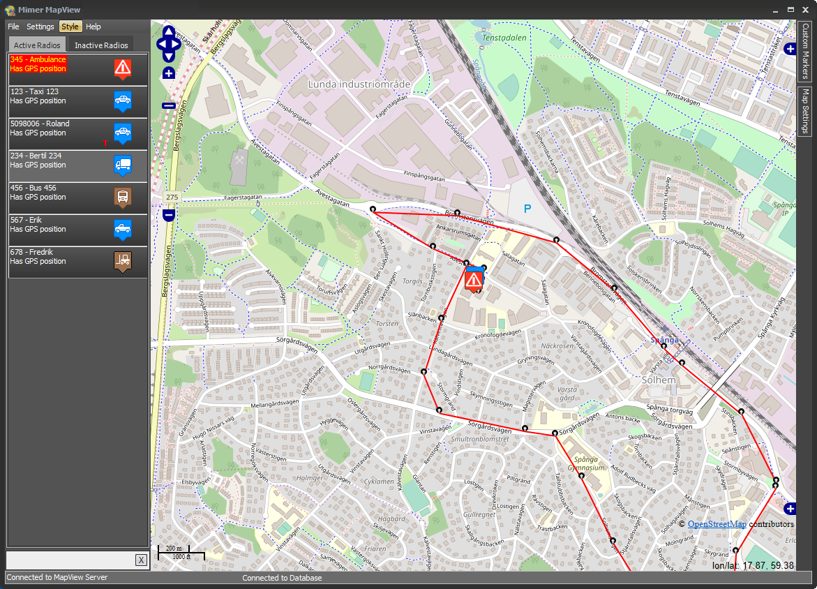
You can activate a trace so that you see the last positions of a certain unit on the map. You can also see a historic trace of a radio showing stored positions.
Setting a custom marker
At the right hand side there is a drop-out menu for adding markers. This can be useful to highlight special points on the map; for example your own office, a large customer etc.
Under that tab are selections for setting the marker by address or by coordinates and giving the marker a name. You can also add a marker by right-clicking on the map and select “Add a marker here” from the pop-up menu.
Emergency Alarm
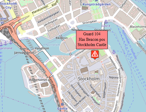
When a radio sends an alarm with a position enclosed, the map will zoom to that event and the radios information box will move to the top of the Active list. A special icon is displayed on the map position to show that it is an alarm state.
If a second alarm is received it will also move to the top of the list but the map will remain on the current position.
Database
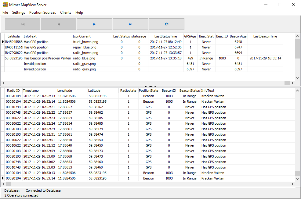
All radios in the system are set up in a database so that they are identified with radio number (ISSI in Tetra), radio name, radio system and an icon to be shown on the map.
Example of Mimer MapView
Example showing a radio trace
Guard 104 has sent an alarm!
All units are set up in a database
Brochure is available on the download page and setup instructions on the technical download page.
DEMO SOFTWARE
There is a demo software available, please ask.
The demo will show 10 units travelling around on the map of your preferred city.
In the demo you can test the alarm function and more.
Maps
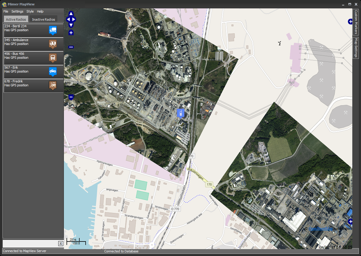
MapView use online maps from Google Maps or Open Street Maps. You can also use downloaded maps or your own detailed maps.
Indoor positioning
There is an option for Sepuras ST-Protect so that you can position indoors through the use of beacons.
Radio System types
MapView handles Motorola and Sepura Tetra systems. In the near future also DMR systems.

